I am a Research Specialist at GfK Geomarketing where I develope new methodology for calculating international market data. Before, I was working as part of the Digital Health Geography research group as a Data Analyst with focus on machine learning, and the intersection of natural environment and human behaviour by developing novel algorithms.
On this website I would like to share some of my private projects where I solve geo-spatial prolems with R.
B.Sc. in Physical Geography (final grade 1.5), 2017 - 2022
FAU Erlangen-Nürnberg
B.Sc. in Applied mathematics and physics, 2016 - 2017
TH Ohm Nürnberg
Subject-specific university admission for social work (Fachgebundene Hochschulreife im sozialen Zweig), 2011 - 2014
Lothar von Faber FOS Nürnberg
Intermediate school-leaving certificate (Mittlerer Schulabschluss), 2009 - 2011
Hauptschule Scharrerschule Nürnberg
Expert
Advanced
Advanced
Intermediate
Intermediate
Beginner
Beginner
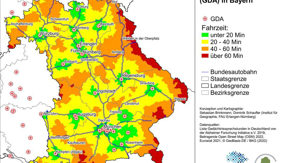
Memory clinics play a crucial role in the qualified diagnosis of dementia. This study aimed to assess the accessibility of memory clinics for people with dementia in Bavaria by utilizing a Geographic Information System (GIS) to calculate travel times from all Bavarian municipalities to the nearest memory clinic using OpenStreetMap data. It was found that the majority (40%; n = 93,950) of modeled individuals with dementia live in communities with an average travel time of 20 to 40 minutes to the nearest clinic, while approximately 7,000 (3%) face a travel time of more than one hour, particularly in rural areas. In light of demographic trends, improving accessibility to memory clinics across all locations is imperative. The expansion of memory clinics in areas with lengthy travel times or the introduction of mobile diagnostic services could enhance care for people with dementia.
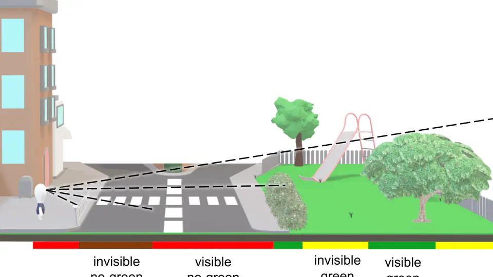
Studies from public and environmental health show strong indication of the importance of visible urban green space. However, current approaches for modelling viewshed based greenness visibility still have high computation costs. Therefore, we propose an algorithm for point-based viewshed computation using a novel prototyping approach. Our evaluation shows an average improvement of 34%. We anticipate that these findings lay the groundwork for further optimisation of point-based viewshed computation, improving the feasibility of subsequent comparative studies in the field of public and environmental health.
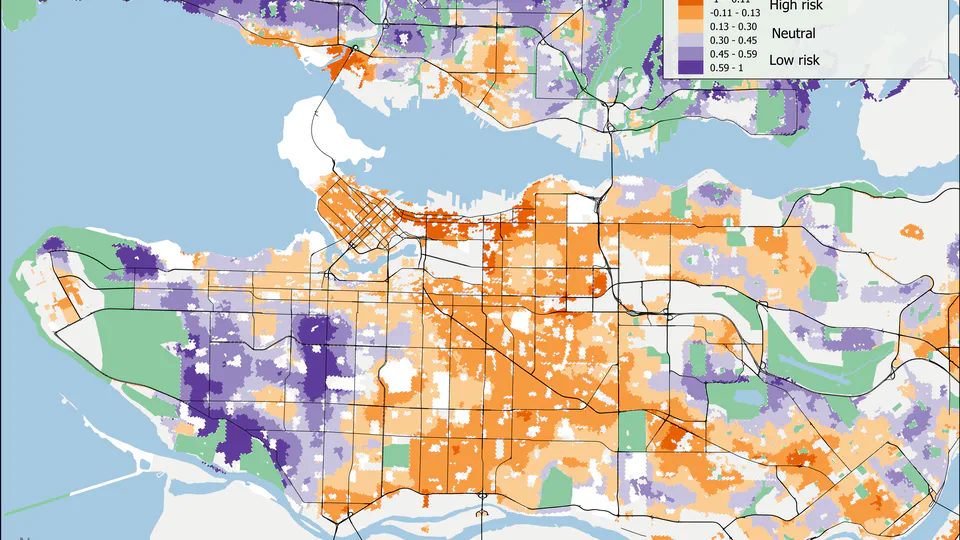
We propose a novel diabetes risk index (DRI-GLUCoSE) derived from socioeconomic status and satellite data based greenspace. We mapped index scores in two Canadian cities (Vancouver and Hamilton) and validated the index using fully adjusted logistic regression models to predict individual diabetes status. The final models achieved a predictive accuracy of 75%, the highest among environmental risk models to date. Our combined index of local greenspace and socioeconomic factors demonstrates that the environmental component of diabetes risk is not sufficiently explained by diet and physical activity, and that increasing urban greenspace may be a suitable means of reducing the burden of diabetes at the community scale.
The GVI R package provides tools for computing a Greenness Visibility Index (GVI) surface from a DSM, DTM and Greenness Surface.
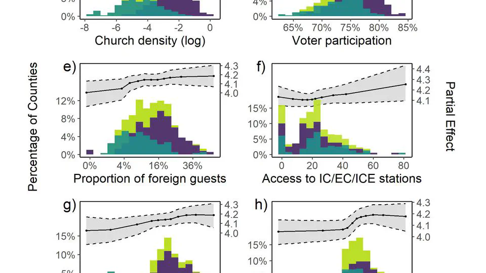
As of 13 July 2020, 12.9 million COVID-19 cases have been reported worldwide. Prior studies have demonstrated that local socioeconomic and built environment characteristics may significantly contribute to viral transmission and incidence rates, thereby accounting for some of the spatial variation observed. Due to uncertainties, non-linearities, and multiple interaction effects observed in the associations between COVID-19 incidence and socioeconomic, infrastructural, and built environment characteristics, we present a structured multimethod approach for analysing cross-sectional incidence data within in an Exploratory Spatial Data Analysis (ESDA) framework at the NUTS3 (county) scale.